

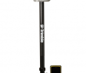
The Trimble® R2 is a compact, durable GNSS receiver that provides an easy-to-use solution for GIS and survey professionals who need to collect highly accurate data in a wide range of geospatial applications.
Capable of delivering between submeter and centimeter positioning accuracy in real-time to any mobile device via a wireless Bluetooth® connection, the R2 receiver gives you total flexibility to choose a solution based on the accuracy and GNSS performance level that suits your application, letting you work the way you want.
- Professional solution for GIS & survey applications ranging from submeter to centimeter accuracies
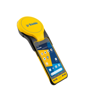
- Easily collect data by pairing with devices such as smartphones, tablets or Trimble handhelds
- Fast to setup, easy-to-use, keeping you productive and focused on your work
- Supports multiple satellite constellations and correction sources for accurate data at any location
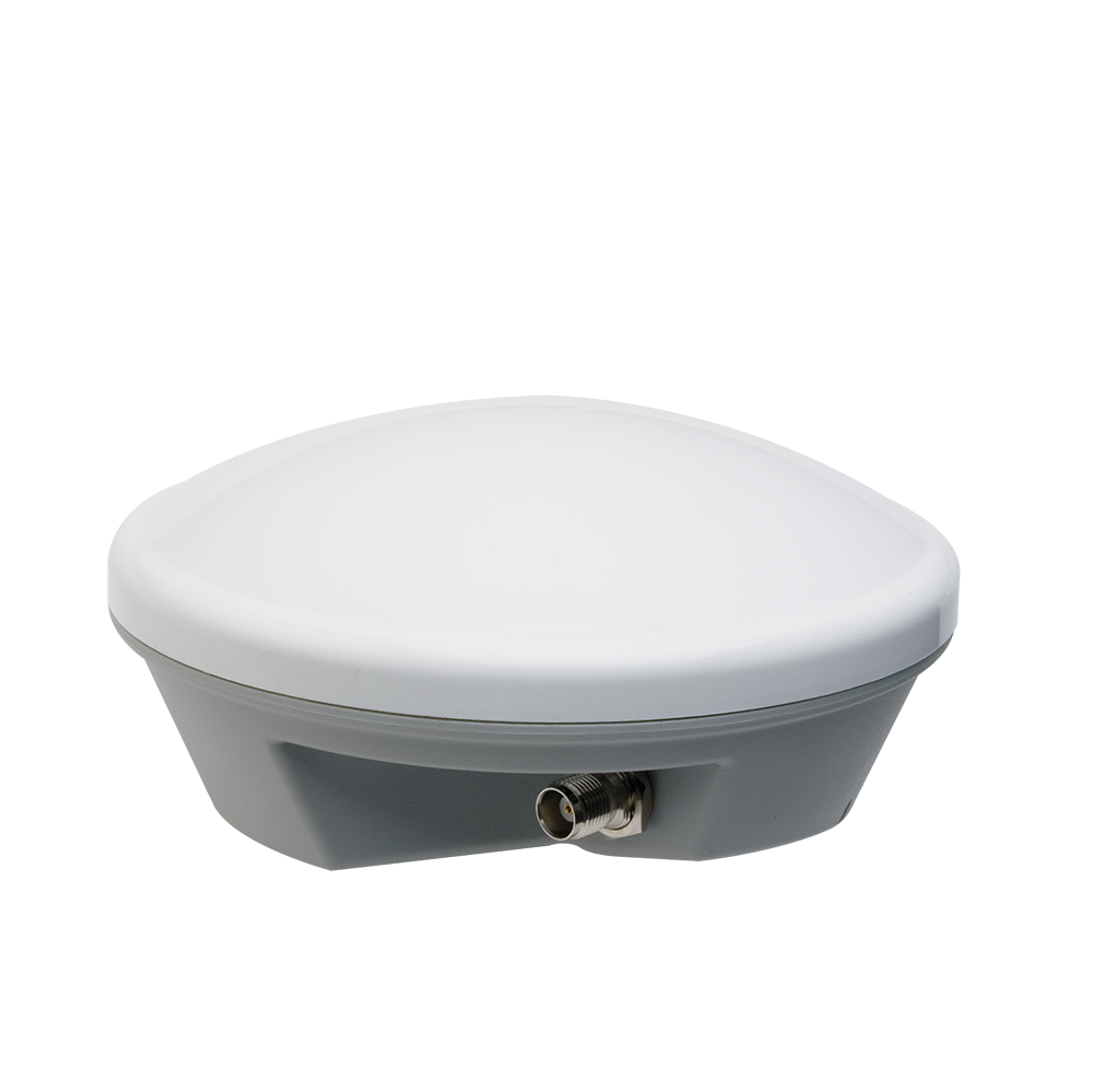
- Compact, cable-free design with integrated antenna
Collected data can be processed with Trimble office software, including Trimble Business Center or TerraFlex, providing you with high-quality deliverables for your organization.
High accuracy for survey & GIS applications 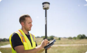
Capable of delivering submeter to centimeter level positioning accuracy in real-time to suit any field data collection application.
Achieve higher accuracy in real-time using correction sources from SBAS and VRS networks to Trimble RTX™ correction services*, delivered by either satellite or Internet, or via traditional RTK methods.
Supports multiple satellite constellations and augmentation systems to provide maximum accuracy and positioning performance.
* Trimble RTX™ available through Trimble applications
Flexible Solution
Able to be paired with any mobile device on a variety of operating systems and platforms, from a Trimble handheld or controller to a modern smartphone or tablet.
You can select the accuracy and GNSS performance level appropriate for your application.
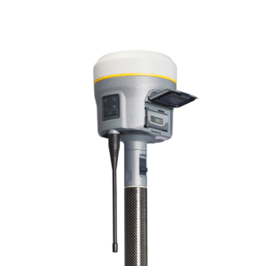
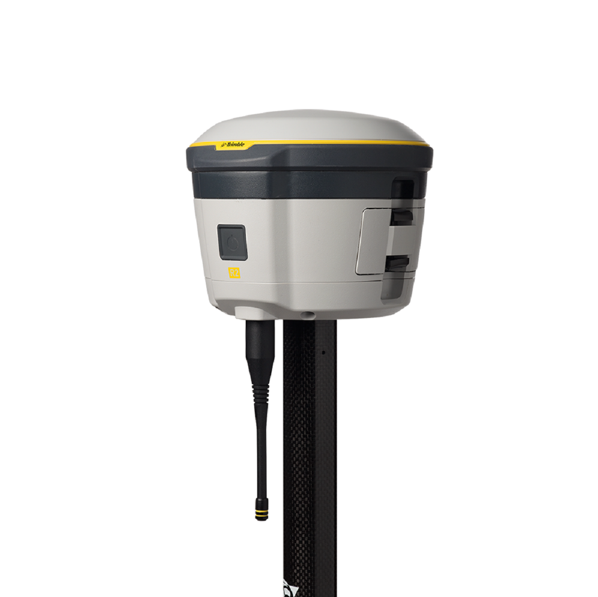
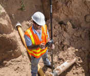
Capable of being operated either mounted on a pole, on a backpack or on a vehicle.
Integrates with Trimble software such as Trimble Access™, Trimble TerraFlex™ and Trimble Business Center to enable data to be easily collected, communicated and processed, providing you with high-quality deliverables for your organization.
Trimble R2 GNSS Receiver for Mobile Devices
The Trimble R2 GNSS receiver is compact and portable weighing only 2.4 lbs. (1.08 kilograms). With one button operation and field swappable battery, the receiver can be pole or vehicle mounted or carried on a backpack. The R2 is a multi-constellation receiver that supports GPS, GLONASS, Galileo, BeiDou and QZSS satellite signals as well as Satellite Based Augmentation Systems (SBAS). With a variety of standard and optional correction capabilities, the Trimble R2 can achieve sub-meter to centimeter positioning for a broad range of accuracy requirements. In addition, the GNSS receiver is an ideal choice for organizations that have adopted a workplace Bring Your Own Device (BYOD) strategy. Its quick setup and ease-of-use increases data collection productivity and time-to-job completion to enable users to work more efficiently.
“Today’s geospatial professionals require flexible solutions which allow for configuration to meet their specific job requirements,” said Ron Bisio, general manager of Trimble’s Surveying and Geospatial Division. “The Trimble R2’s versatility to support GIS and survey workflows as well as BYOD deployment enables geospatial professionals to collect data using the mobile device, workflow and accuracy they choose.”
Workflows – GIS and Survey Field Software
Designed for both GIS field data collection and survey workflows, the Trimble R2 receiver integrates with Trimble TerraFlex™ mapping and GIS field software and Trimble Access™ survey field software.
TerraFlex software is a scalable cloud-based solution for geospatial data collection. By pairing the R2 with a smart device or Trimble handheld running TerraFlex, the solution addresses a wide variety of field requirements including attribute-rich GIS data collection on consumer and professional devices. With an intuitive interface and streamlined toolset for creating custom digital form templates, TerraFlex keeps the data flow standardized and streamlined from the field to the office.
Trimble Access software supports the workflows of everyday surveying tasks such as topographic and control surveys and specialized surveying tasks such as roads, monitoring, tunnels and mines. By pairing the receiver with a Trimble handheld running Trimble Access or TerraFlex field software, the Trimble R2 is a versatile solution that supports the full range of geospatial data collection workflows for both GIS and survey applications.
Flexible Accuracy
Capable of receiving a broad range of corrections from traditional RTK, VRS networks and SBAS to Trimble RTX™ correction services via cellular/IP connections or satellite (L-band), the Trimble R2 provides high-accuracy data worldwide.
The R2 GNSS receiver can leverage the entire portfolio of subscription-based Trimble RTX correction services to accommodate a wide range of applications and accuracy requirements. This includes CenterPoint® RTX (less than 4 centimeters), RangePoint™ RTX (less than 50 centimeters), and ViewPoint RTX™ (less than 1 meter) correction service.