The Trimble Zephyr 3 antennas offer full support for current and near-future GNSS signals including GPS, GLONASS, Galileo, BeiDou, OmniSTAR, Trimble RTX, and SBAS. Combined with rugged durability, the Trimble Zephyr 3 antenna will be a long-term investment.
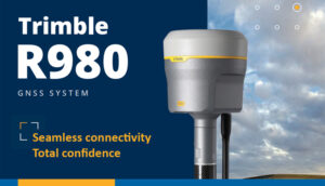
Seamless connectivity. Total confidence.
The Trimble® R980 GNSS system unlocks peak accuracy and productivity for land surveyors with proven GNSS performance. Overcoming challenging GNSS conditions and excelling in remote locations, the R980 is ready to work wherever the job leads you.
]]>With unparalleled GNSS performance in tough conditions, robust tilt compensation and seamless workflows, the highly reliable R980 provides trust and confidence on every job site.
Productive, connected workflows
Boost productivity with measurably better performance under difficult GNSS conditions and stream corrections using a full suite of connectivity options to suit the job.
Work faster and more efficiently
Robust IMU-based tilt compensation lets you forget about leveling the pole, enabling you to get into tight places and get more done, faster than you thought possible.
Key specifications
Accurately stake out and measure points faster and in more locations with the R980 and dramatically improve your survey productivity.
-
8 mm H/15 mm V: Real-time kinematic precision
-
RTK + 3mm + 0.15mm/° tilt :TIP positioning performance
-
2 cm H/3 cm V: CenterPoint® RTX precision
Trimble R580
Proven, reliable positioning
Depend on the Trimble® R580 GNSS system to keep you working with survey precision. Powered by the industry-leading Trimble ProPoint® GNSS engine, this everyday integrated receiver delivers greater productivity and reliable accuracy in more places.
The Trimble® Zephyr Model 3 external dual-frequency antenna contains advanced technology for minimizing multipath, outstanding low elevation satellite tracking, and extremely precise phase center accuracy. The Zephyr Model 3 antenna can be mounted on a range pole—along with the Trimble Geo 7X handheld—to give you a convenient all-on-the pole data collection solution.
The Zephyr Model 3 antenna is the supported antenna for use with the Trimble Geo7X handheld in the Centimeter-enabled configuration.
Key Features
- Comprehensive GNSS support, including GPS Modernization signals, GLONASS, BeiDou and Galileo
- Robust low-elevation satellite tracking
- Minimized multipath
- Sub-millimeter phase center repeatability
The Trimble® Tornado external dual frequency antenna contains advanced technology for extremely low multipath, outstanding low elevation satellite tracking, and high phase center accuracy. Use the Tornado antenna together with a Trimble H-Star enabled handhelds and receivers for high-accuracy mapping and GIS data collection.
The Trimble® Tempest is a high quality L1 GNSS antenna for Geo 7 series handheld and is resistant to signal interference and multipath. Ideal for all mapping applications, it is especially useful in difficult environments such as under canopy and in urban canyons.
GNSS positioning service. The DA2’s performance scales with your Trimble Catalyst service subscription to deliver anywhere from centimetre to sub-meter precision to location-enabled Android and iOS field apps & workflows.

Professional Performance
- Custom engineered and powered by Trimble ProPoint GNSS technology.
- Multi-band support for all global and regional GNSS systems: GPS, GLONASS, Galileo, BeiDou, QZSS, NavIC/IRNSS, SBAS, MSS/L-Band.
- Excellent phase-centre stability and robust multi-path rejection characteristics in difficult GNSS environments.

Lightweight & Convenient
- Trimble’s smallest and lightest RTK-capable GNSS receiver: at only 330g (<12 oz), DA2 is small enough to carry anywhere.
- Simple Bluetooth® connection to Android and iOS devices.
- Powered in the field using an off-the-shelf USB power bank or any USB-C equipped field device.
- Multiple mounting options

Simply Precise Positioning
- DA2 is custom-designed for the Trimble Catalyst positioning service, simplifying your access to precise positioning workflows.
- Compatible with any of the Catalyst service subscription levels, one receiver can be used for every workflow.
- Trimble Corrections Hub delivers seamless correction services worldwide, online or offline.


Choose Your Precision
From centimetres to sub-meter, simply pick the Catalyst subscription level to suit your needs.

Purchase Your Subscription
Pay per hour, per month, or per year. Catalyst subscriptions deliver GNSS performance and corrections as an all-in-one service.

Grab a DA2 Receiver
Lightweight, inexpensive and precise, the DA2 for Catalyst works with every Catalyst subscription level.

Connect & Go!
Connect your DA2 to your phone or tablet, launch your app, sign-in to Catalyst, and away you go!

ACCURACIES
Catalyst subscriptions are available at a range of accuracy levels to suit your particular job requirements.
Catalyst 1 = Centimeter-level (1 cm)
Catalyst 10 = Decimeter (10 cm)
Catalyst 30 = Sub-foot (30 cm)
Catalyst 60 = Sub-meter (60 cm)
Whether you’re carrying out mapping or mobile GIS data collection projects, Catalyst has the positioning accuracy for every workflow.

PURCHASING OPTIONS
You’re always in complete control over how much you spend and when you spend it. What could be simpler?
Catalyst monthly and annual subscriptions are ideal for seasonal, project-based, and predictable usage.
Purchase a subscription for one month-at-a-time, multiple months-at-a-time or annually for a fixed number of users, at the level of accuracy you and your teams require
Catalyst On-Demand hourly usage plans are perfect for unpredictable and fluctuating usage and team sizes. Purchase from as little as 10 hours at a time for use by any number of users, and receive centimeter-level accuracy for your workflows.

CORRECTION HUB
Catalyst subscriptions include worldwide and configuration-free access to Trimble correction services through the Trimble Corrections Hub (TCH) which bundles access to Trimble VRS Now and Trimble RTX services for every subscriber at no extra cost.
TCH dynamically selects the appropriate correction service based on the environment, availability, and your subscription level.
Or, use your own local correction sources if you prefer.
outdoor augmented reality system you can.
SiteVision is a user-friendly Augmented Reality system that brings 3-Dimensional data to life in real-world environments so you can easily visualise, explore and understand complex information with unrivaled ease and accuracy.


Take a walk through your job site and visualise

- Conceptual designs, from buildings to roads, as they might appear in real life
- What lies beneath the ground or resides inside walls, such as water pipes and electrical cabling
- Communicate complicated plans and drawings
- Precisely identify where concealed assets are
- Minimize costly errors and safety related incidents
Simply upload your data, visualize and manipulate it in the field, and report back to the office—all through the Trimble Cloud.
Easy-to-use software brings data to life

- Automatically place models on site, with centimeter-level accuracy
- View fully textured models in 3D, plan view or cross-section
- View any attributes in your model
- Adjust model opacity or cross-section to understand context
- View subsurface models with PitView
SiteVision supports Trimble, open industry standard, and third-party file types (TBC, SketchUp, Esri, AutoCADWorks) so you can seamlessly integrate with your existing workflows and data.
Compatible Devices
Trimble SiteVision runs on mobile devices, smaller than 8″, supporting Google Play Services for AR and the Android Operating System Version 9.0.
Trimble Inc. has tested and verified Trimble SiteVision compatibility with the following Android mobile phones:

Streamlined, integrated solution
- Centimeter-accuracy GNSS positioning with the Trimble Catalyst software-based receiver
- Remote measurement with an Electronic Distance Measurement (EDM) rangefinder
- Flexible design fits user-supplied Android 9 phones (up to 8” screens)
- Waterproof and rugged
- Works handheld or pole-mounted
Seamless workflows between the field and office
Upload your data, visualize it in the field and report back to the office—all through Trimble Connect. SiteVision works with data from Trimble’s full range of data collection, design and modelling tools, and data available in open industry standard formats:
SKP, VCL, TTM, TRB, IFC, LandXML, DWG, SHP, Geodatabase, and PNG.
APPLICATIONS
SiteVision for Geospatial
SiteVision unlocks and simplifies the use of geospatial information by allowing you to see your data in the real world – from property lines to underground services to conceptual designs – making it the ideal tool for public and contractor engagement in planning processes as well as throughout the project lifecycle
With the demand to capture and update geospatial data accurately and reliably, SiteVision helps create efficient deliverables and drive good decisions based on the best information available.
Utilities
- Replace paint marks and 2D plans with precise visualizations.
- Verify and confirm database integrity, improve safety, and enhance awareness on the job site.
- Turn existing GIS data into easy to understand 3D models complete with attributes for public and contractor engagement.
- Check utility location offsets from property boundaries and occupation, or measure the distance between pipes, pylons or valves within your model.
- Supports 2D and 3D data from Esri databases, digital elevation models, .DWG, .SKP and .IFC data formats.
Local Government
- Promotes citizen engagement and collaboration between government offices, inspectors and public stakeholders which ultimately help save you time and money.
- Delivers real time visualizations of information such as locating emergency services following a disaster, planning a public works project, or protecting and preserving a cultural or heritage site.
- Displays complex government database information as easily understood visualizations so that issues and discrepancies can be quickly identified and reported leading to efficient and confident decisions.
Cadastral Survey
- Visualize parcel boundaries in real time in the context of the field environment
- Accurately locate buried monumentation
- Monitor site progress through easy to understand visualizations
- Turn existing geospatial data into easy-to-understand 3D models complete with attributes for public and contractor engagement
is a revolutionary GNSS concept delivering positioning-as-a-service to mobile devices. With the addition of the simple, lightweight Trimble DA2 GNSS receiver and an on-demand accuracy-based subscription, turn your Android or iOS device into a precision mapping, navigation, and measurement tool you can use with any location enabled app or service.
Features & Benefits
Catalyst is Simple
Any location-enabled app, on any Android or iOS device, Catalyst delivers precision positioning without the hassle.
Catalyst is Flexible
Easily modify your accuracy level and team size as your requirements change.
Catalyst is Affordable
Once you have the powerful, yet low cost, Trimble DA2 receiver, only pay for the desired accuracy and time your projects require.
Catalyst is Precise
No matter what the task, Catalyst delivers Trimble precision and position quality to any location-enabled workflow.
How it works
Choose Your Precision
From centimetres to sub-meter, simply pick the Catalyst subscription level to suit your needs.
Purchase Your Subscription
Pay per hour, per month, or per year. Catalyst subscriptions deliver GNSS performance and corrections as an all-in-one service.
Grab a DA2 GNSS Receiver
Lightweight, inexpensive and precise, the DA2 works with every Catalyst subscription level.
Connect & Go!
Connect your DA2 to your phone or tablet, launch your app, sign-in to Catalyst, and away you go!
Convenient features, such as an integrated 4G LTE modem, four-line reversible front panel display, and USB-C PD charging, make the Trimble R750 a powerful tool for a variety of surveying applications.

8 mm H / 15 mm V
Real time kinematic precision

336
GNSS channels

External
GNSS antenna